Snapshot Cal Coast Logo outline of the state of CA with silhouette of animals and photo of intertidal seaweeds & a starfish

Pisaster ochraceus and tidepool diversity. Pillar Point, San Mateo County, CA

0

Snapshot Cal Coast is in Summer 2024! Help us document California's incredible biodiversity on your own or at a bioblitz event near you.

For two weeks every year, the California Academy of Sciences—with support from the California Ocean Protection Council, the California Department of Fish and Wildlife, and the MPA (Marine Protected Area) Collaborative Network, and many other partners—mobilizes communities from Del Norte to San Diego to make and share observations of plants, animals, and seaweeds along the California coast using the iNaturalist app. By creating a real-time, statewide snapshot of current species ranges, we're building a community of observers that provides valuable data for scientists at local, regional, and state levels, and answering targeted research questions in support of California Marine Protected Areas.

0

Getting started is a snap!

Close-up of a person taking a picture of tidepool animal with iPhone

Participating in Snapshot Cal Coast is as easy and fun as a day at the beach. Get started in six easy steps:

  1. Download the iNaturalist app for iOS or Android.
  2. Create an account to start making observations.
  3. Join the Snapshot Cal Coast 2023 iNaturalist project 
  4. Head to the coast on your own time or during a bioblitz to make and share observations of plants and animals you see, especially species on our "most wanted" list (see below).
  5. Observe during low tide. See NOAA's tide table to find exact times for low tides near you.
  6. Spread the word with hashtag #SnapshotCalCoast!


0

Keep tidepool etiquette top of mind

  1. Observe things where you find them. Never remove animals, rocks, shells, seaweeds, or plants from the tidepools.
  2. Walk gently, taking care to avoid stepping on animals or seaweeds.
  3. Do not “roll” rocks. Animals living on the underside of rocks can only survive there.
  4. Be aware of the wildlife around you and try to minimize disturbances.
  5. Be careful! Tidepools and rocky shorelines are slippery, and tides and waves can catch you off guard. Never turn your back on the ocean.
0

Most-wanted species

In addition to documenting as many species as possible from as many places as possible, we are also interested in learning more about a handful of “most-wanted” species and groups. These include introduced species for which we have limited data on their ranges, species whose ranges are affected by changing oceanic conditions and habitat modification, and species that are affected by emerging diseases.

Check out the iNaturalist Most Wanted Species Guide for more information.

Native rocky intertidal species

Anemones

Abalone

Snails in the genus Nucella

Snails in the genus Tegula

Chitons

Lottia gigantea (Owl Limpet)

Nudibranchs

Strongylocentrtus purpurartus (Pacific Purple Sea Urchin)

Kelps

Non-native species

Seaweeds

Watersipora Bryozoans

Tunicates

Crabs

Mud Snails

Worms

Join Upcoming Bioblitz Events

Interested in helping plan events for summer 2024? Reach out to our team at communityscience@calacademy.org 

Map of California Coast

How we are using these data?

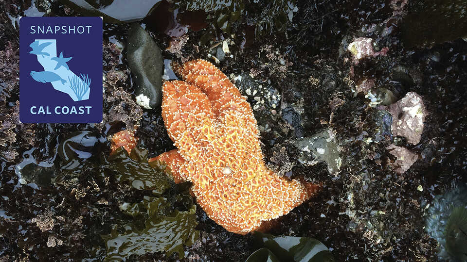
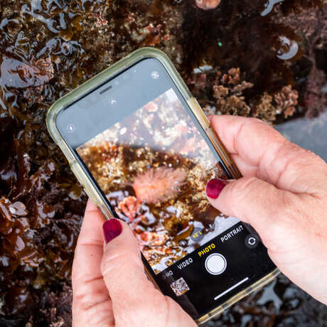
Observations contributed by volunteers, community, and community scientists during Snapshot Cal Coast and year-round via iNaturalist make up an increasingly large proportion of our knowledge of biodiversity over space and time on the California coast. Our team—a collaboration between the California Academy of Sciences, the California Ocean Protection Council (OPC), and the California Department of Fish and Wildlife (CDFW)—is building the capacity to use these crowdsourced community-contributed observations to understand and monitor biodiversity across California’s coastal and marine protected areas.

Our data science efforts were initiated by Dr. Giovanni Rapacciuolo and are now led by Dr. Natalie Low and focus on developing innovative approaches and tools to translate crowdsourced community-contributed observations into meaningful indicators of biodiversity change on the California coast in support of California’s long-term MPA Monitoring Action Plan and the Ocean Protection Council's Strategic Plan. In particular, we are now focusing on mobilizing the community of volunteer naturalists, community, and community scientists to power an Early Warning and Forecasting System for biodiversity change on the California coast. This system will combine crowdsourced community-contributed observations with state-of-the-art ecological models to track key metrics of ocean and coastal health over time (e.g. distribution and abundance of native species, spread of invasive species, emergence of marine disease) and forecast changes in those metrics associated with a changing climate. This effort will provide resource managers with the tools necessary to slow or stop biodiversity loss in California’s coastal and marine habitats and will also empower community scientists to take an active role in conserving biodiversity.

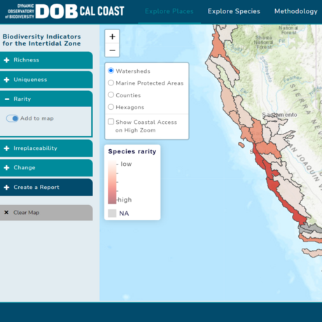
You can find out more about how we are using data contributed by the community during Snapshot Cal Coast and year-round via iNaturalist, as well as explore and interact with our findings, by visiting http://calcoast.dob.bio. You can also watch the short talk by Dr. Rapacciuolo below about our data analysis efforts.