Special delivery! See our visiting baby camels (Dec. 6–19) and yaks (Dec. 20–Jan. 5) this holiday. Learn more

Antarctic Item 028 is another artifact retrieved from Marble Point. Like the previous strand of wire, this too suggests a line graph. This one takes a downward-slope however, similar to a diagram released by the U.S. National Snow and Ice Data Center showing the extent of Arctic sea ice at the end of August 2013. 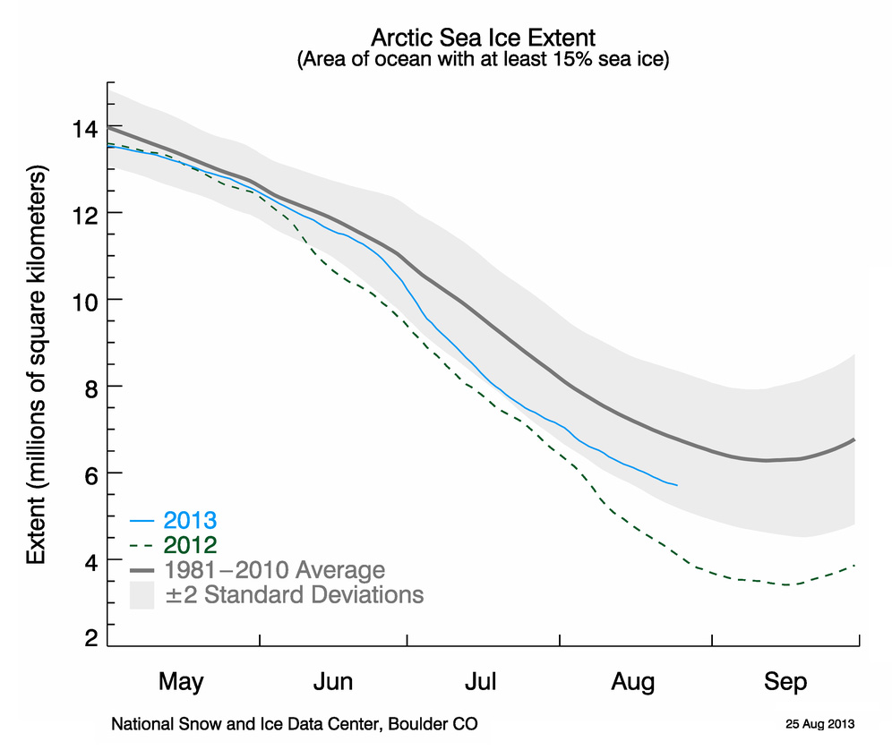 As the graph shows, Arctic sea ice fared better in 2013 than the previous summer. 2012 was a dire year, having broken the 2007 record for lowest daily extent of the satellite area. Another indicator of fundamental change to the Arctic is ice thickness (not indicated in this graph). Long-term satellite data shows ice thickness declining as fast or faster than its surface area. The Arctic was previously replete with ice that had survived multiple summer thaws, steadily gaining volume over the years. Today, very little of this old mass remains.